China’s Hydropower Project on Yarlung Tsangpo Threatens Tibet’s Fragile Ecosystem and Regional Stability
On July 19, China announced the commencement of the construction of what is set to become the world’s largest hydropower project on the lower reaches of the Yarlung Tsangpo in Nyingtri (Ch: Nyingchi), Tibet. The project comprises of five cascade power stations with a total investment of about 1.2 trillion yuan, and it is targeted to be operational by early 2030. It is expected to generate around 300 billion kilowatt-hours of electricity annually, roughly three times that of the Three Gorges Dam.
Along with the announcement of the hydropower project, the Chinese government also launched China Yajiang Group Co., Ltd., a state-owned enterprise (SOE) specifically established to oversee the construction and operation of this strategically significant project. The formation of China Yajiang Group marks the creation of a project-specific SOE, reflecting the project’s immense technical complexity, scale, and geopolitical strategic significance—given its location in Tibet and close proximity to the Indian border. The Chinese official media have hailed the project as a project of the century aligned to achieve China’s net zero and clean energy ambitions.
Yet, beneath these celebratory headlines lies a profound concern about environmental, social and geopolitical risks, as the Chinese government has not disclosed any information about the project design, location or any impact assessment of the project.
Design of Mega Dam
However, several unofficial Chinese language media sources provide an insight into the potential design of the hydropower power project. According to these reports, the project would involve the construction of two reservoirs: a smaller dam in Minling town as Mainling Hydropower Station to regulate river flow and a larger one near Pe town (Ch: Pei) in Minling (Ch: Mainling) county to intercept the river and divert the water through a tunnel passing through Namcha Barwa mountain to Metok (Ch: Medog).
The overall plan is to harness the 2000 meter drop over 50 km through the Yarlung Tsangpo and adopt a development method of straightening the river bends and diverting water from Pe town to Metok town (Ch: Medog) via tunnels incorporating a system of five cascade hydropower stations along the route. The project will also spur the development of solar and wind energy resources in surrounding areas, thus creating a clean energy base featuring a mix of hydro, wind and solar power.
Plans to construct a hydropower project on the lower reaches of the Yarlung Tsangpo have existed for decades. Over the years multiple surveys have been conducted to explore how to harness the immense energy potential of the world’s deepest canyon. However, due to significant technical and geological challenges, the project had been put on hold until now. China now claims to have overcome these challenges and is pressing ahead, eager to showcase its technological prowess and leadership in green energy.
While it may indeed be technically feasible for China to build this project in such a challenging terrain, the greater concerns lie in the silence surrounding its potential social, environmental and geopolitical consequences.
Seismic Consequences
The Yarlung Tsangpo basin lies along the seismically active southern margin of the Tibetan plateau where the river flows through the intersection of two major tectonic suture zones: the Tsangpo suture and the Eurasian-Indian suture. This complex geodynamic setting has historically produced numerous high magnitude earthquakes and landslides including the devastating 1950 Metok earthquake (magnitude 8.6) and 2017 Nyingtri earthquake (magnitude 6.9). Since the early 20th century, the area has experienced over 800 seismic events with magnitude of 3.0 or higher recorded in or near the basin.
Excavation for the proposed tunnel through the Namcha Barwa mountain would require extensive rock blasting due to the region’s complex geology. Some experts speculate that China may even consider using nuclear materials to facilitate the blasting process given the scale and difficulty of the terrain. Furthermore, the excavation is expected to generate a substantial volume of debris. Managing or disposing of this material in a narrow and steep landscape could significantly elevate the risks of landslides. In fact, a geological survey has already documented at least 2,390 landslides within the basin. These data only substantiate critical concerns about the feasibility and safety of constructing a large-scale hydropower project in an active seismic zone.
Development for Whom?
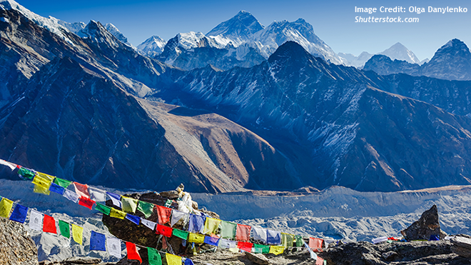
Beyond its ecological fragility, the Yarlung Tsangpo is the world’s highest transboundary river flowing through Tibet, India and Bangladesh. In Tibet, Tibetans have lived alongside this river for centuries, considering it sacred and a source of livelihood. This new hydropower project threatens to submerge towns as well as culturally and historically significant sites. Despite its vast impact, local Tibetans were neither consulted nor properly informed about the project. The presence of local Tibetan representatives at the project inauguration was largely symbolic, lacking any meaningful participation.
China has also announced that hydropower generated through the project would be mainly transmitted outside Tibet. Some experts believe that some of the electricity generated from this dam is going to be sold to energy-hungry Myanmar. Once again, Tibet’s natural resources are being extracted for the benefit of distant cities and neighboring countries while the local population bears the brunt of the ecological and cultural impact.
For downstream countries, the implications are equally severe. The Yarlung Tsangpo becomes Brahmaputra as it flows into India irrigating vast stretches of the northern plains of Assam before entering Bangladesh and emptying into the Bay of Bengal. This river is not just a river, it has shaped the demography, economy, culture and flora and fauna of downstream communities living along its banks in India and Bangladesh. Any unilateral action on the river poses a serious risk to regional stability.
Beijing presents the projects as a symbol of modernity and clean energy. But the reality is more complex. A dam is not simply concrete and turbines. It is a rupture in the landscape, a redrawing of ecological relationships, potentially causing a displacement of life and geopolitical conflict. Tibet deserves sustainable development that prioritizes local agency, ecological wisdom, and transboundary cooperation, not top-down megaprojects that serve political and economic goals at the expense of people and ecosystem.
It’s time to ask: Development for whom? At what cost? And who gets to decide?